3 Scenic Gran Canaria Road Trips: Coast, North and Mountains
20 August 2026
In Gran Canaria, the coast, inland villages and mountain peaks may look close together on a map. In reality, the winding roads and changes in altitude mean it makes sense to explore one area at a time.
That’s why we’ve put together three scenic driving routes in Gran Canaria. They are ideal if you are looking for places to visit in Gran Canaria by car. Compare their starting points, distances, difficulty levels and scenery before choosing the one that best suits your plans.
For a relaxed drive, start on the east coast. To combine villages, archaeology and the sea, choose the north-west route. For a scenic drive through Gran Canaria's mountains, pick a day with good weather and allow extra time in your schedule.
Contenido
Before you set off
- ✓Check traffic and road conditions before setting off, especially if you are heading towards the mountains or the west.
- ✓Check the available trails and routes before visiting Gran Canaria's natural areas.
- ✓Check the weather forecast and take water and a warm layer, especially if you are heading into the mountains.
- ✓Save your route before you set off. Add your stops to your sat nav and review the full journey to avoid diversions or last-minute changes.
Comparison of 3 Gran Canaria driving routes
| Route | Start | Distance | Driving time | Difficulty | Best for |
|---|---|---|---|---|---|
| East coast and capital | Maspalomas | 81 miles | 2 hrs | Easy | Coast, heritage and city |
| North and north-west | Las Palmas | 47 miles | 1 hr 25 mins | Easy to moderate | Villages, archaeology and sea |
| Mountains | Maspalomas | 62 miles | 2 hrs 58 mins | Moderate to challenging | Mountain scenery and villages |
1. East coast and Las Palmas de Gran Canaria route
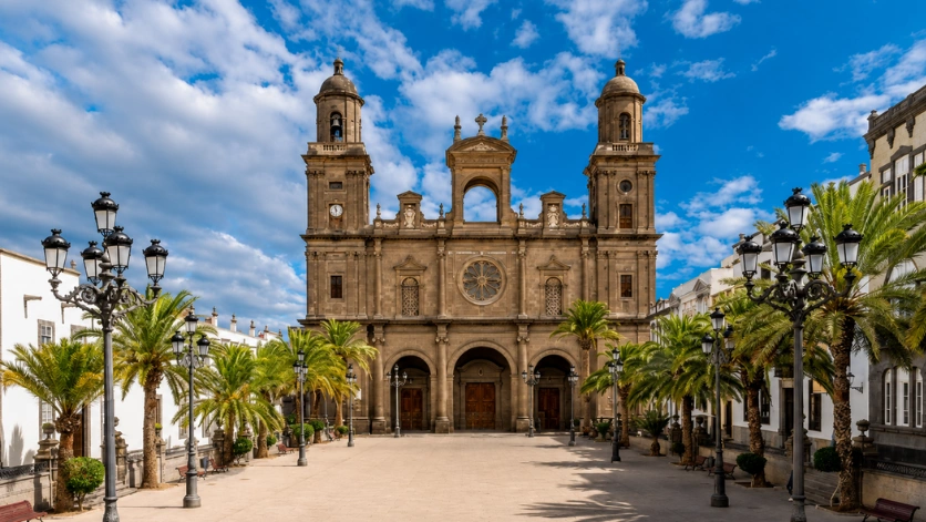
Vegueta, one of the main stops on the east coast and capital route
Itinerary: Maspalomas → San Agustín → Telde → Vegueta → Las Canteras → Maspalomas.
This route combines coast, heritage and city without taking you onto mountain roads. It is the easiest option if you are staying in Maspalomas or Playa del Inglés and would prefer an easy day’s driving with several stops to explore on foot.
| Stop | Suggested time | What to prioritise | Access and parking |
|---|---|---|---|
| San Agustín | 60–120 mins | Seafront promenade and beach | Use authorised areas and check sea conditions before swimming. |
| Telde | 60–90 mins | Historic San Juan and San Francisco neighbourhoods | Park in a public area and continue on foot through the town centre. |
| Vegueta | 90–120 mins | Historic streets, the area around the cathedral and one museum of your choice | Park in a public car park and explore the neighbourhood on foot. |
| Las Canteras | 90–120 mins | Seafront promenade and a lunch stop | Use a public car park; avoid driving around looking for an on-street parking space at busy times. |
To enjoy Vegueta without rushing, choose your stops for the day carefully. The neighbourhood has highlights such as Casa de Colón, Santa Ana Cathedral and the charming Ermita de San Antonio Abad, as well as the CAAM museum (Centro Atlántico de Arte Moderno) for contemporary-art lovers or El Museo Canario to learn more about the island's ethnographic history.
Our local tip
Park once in Vegueta, then continue on foot. You will save time and enjoy the historic quarter more.
Interactive map for route 1 — open preview
2. Northern and north-western Gran Canaria route
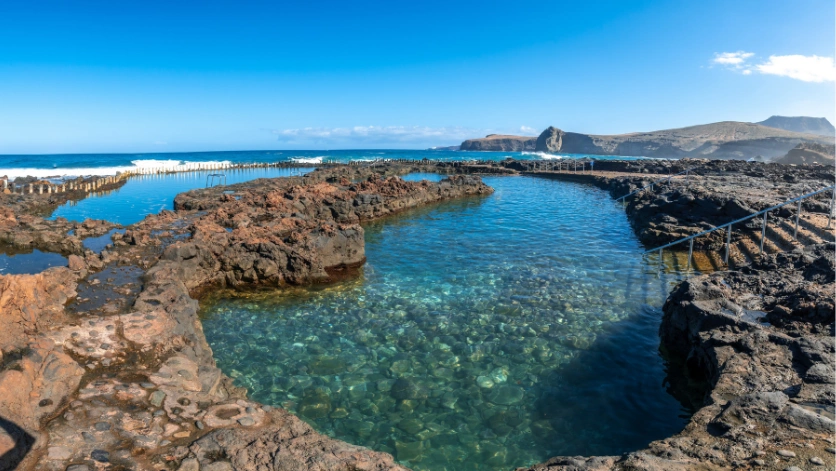
Las Salinas natural pools in Agaete, on Gran Canaria's north coast
Itinerary from the capital: Las Palmas de Gran Canaria → Arucas → Gáldar → Agaete/Puerto de las Nieves → Las Palmas de Gran Canaria.
| Stop | Suggested time | What to prioritise | Access and parking |
|---|---|---|---|
| Arucas | 60–90 mins | Historic quarter and the area around San Juan Bautista Church | Park in a public area and explore the town centre on foot. |
| Gáldar | 90–120 mins | One main cultural visit, such as the Cueva Pintada Museum and Archaeological Park | Check opening times and book ahead if you want to visit a particular site. |
| Agaete / Puerto de las Nieves | 90–120 mins | A seafront walk, lunch and Las Salinas if conditions are safe | Use designated areas and do not go near the pools when the sea is rough. |
You can add more to your itinerary with our guide to northern Gran Canaria and browse our selection of natural swimming pools in Gran Canaria before heading to Las Salinas.
Our local tip
If you want to combine Arucas, Gáldar and Agaete in one day, choose just one longer cultural visit. Leave the rest of your time for a walk, lunch and the sea.
We do not recommend adding La Aldea de San Nicolás, Puerto de Mogán and the return to the south as though they were quick stops. In parts of the west, the terrain can make journeys take longer. If you would like to visit La Aldea, plan a dedicated trip and check road conditions.
Interactive map for route 2 — open preview
3. Mountain route from the south
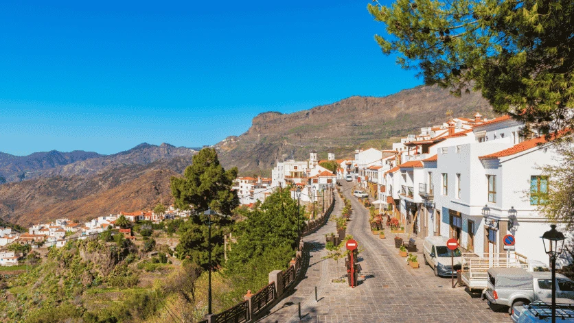
Tejeda, one of Gran Canaria's inland villages
Main itinerary: Maspalomas → Fataga → Tunte → Tejeda → Maspalomas.
The climb from Maspalomas towards Fataga and Tejeda shows how the landscape changes from the dry south to the mountainous interior. On this route, the journey is part of the experience: take your time and stop only in designated places.
| Stop | Suggested time | What to prioritise | Access and parking |
|---|---|---|---|
| Fataga | 30–45 mins | A short walk around the traditional village | Only stop in designated areas. Park safely before taking photos. |
| Tunte | 45–60 mins | Village centre and a coffee or lunch break | Use signposted car parks and avoid blocking access. |
| Tejeda | 90–120 mins | Village, viewpoints and views towards Roque Bentayga | If you add Roque Nublo, reduce your other stops and check access and booking requirements. |
Our local tip
Set off early and make Tejeda your longest stop; this gives you time to decide whether to return via Teror or San Mateo.
Roque Nublo: check access before you set off
If you want to visit Roque Nublo, plan that part of the day before setting off. Check the bus timetables, use the designated park-and-ride car parks and make an advance booking where required. A visit to Roque Nublo can take several hours once you factor in the journey there and back and the walk itself, so reduce your other stops to avoid an overly long day.
Alternative to the Fataga climb: Santa Lucía and La Fortaleza
If you would rather reach Tejeda from the south-east, you can travel via Santa Lucía de Tirajana and include La Fortaleza de Ansite, provided you have enough time and check its opening times and access conditions in advance. For a more direct day out, stick to the main route via Fataga and Tunte.
Want to include Barranco de las Vacas? Plan it separately
We mention it because some routes to Tejeda via Agüimes, Temisas and Santa Lucía pass close to Barranco de las Vacas, one of Gran Canaria's most photographed places. However, its growing popularity has created a serious parking problem, so it should not be treated as an impromptu stop: it is not part of the main itinerary via Fataga or the alternative suggested for this day.
There is no official car park at the site. In practice, many visitors leave their cars in a small unpaved area beside the GC-550 at kilometre 14, which is not suitable for safe parking. Cars parked there can obstruct the road and create safety risks for pedestrians, local residents and other road users on this winding road.
In recent months, there have also been acts of vandalism against cars parked improperly on the verge or on private land nearby. To avoid fines, damage to your vehicle and inconvenience for local residents, we recommend that you do not drive there: the most sensible option is to take public transport to a nearby point and complete the route on foot. It is a more sustainable choice and helps reduce pressure on this natural area. If you still decide to go by car, park only in permitted, safe places — never on bends, verges, access roads or private land. If you cannot find an authorised option, leave it for another day.
Interactive map for route 3 — open preview in Google Maps
Tips for driving in Gran Canaria
On Gran Canaria’s roads, allow for the type of road, not just the distance. A short journey can take a considerable amount of time if it crosses the mountains. Check the route and allow extra time beyond your sat nav's estimate.
Be patient and considerate towards other road users. Inland, you will find bends, blind crests, cyclists and narrow sections. Adjust your speed and overtake only when it is safe.
Fill up before heading uphill. There are more petrol stations on the coast than on some inland routes. Start your journey with enough fuel.
Make the most of daylight hours. If the weather changes or a visit takes longer than expected, skip a stop. The route will still be enjoyable even if you do not tick every box.
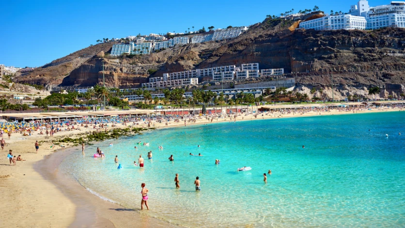
Anfi del Mar beach, Gran Canaria
Frequently asked questions
Discover Gran Canaria at your own pace
A car gives you the freedom to adapt your route as you go. Keep your timetable flexible and make the most of the stops that interest you most, even if that means missing out on another visit.
Already know which route you would like to take? Explore TopCar car hire in Gran Canaria and choose the car and pick-up point that best suit you, your luggage and your plans for exploring the island.
That is what it is all about: turning every route into miles of memorable experiences.
